
☛ Website | Flickr | Instagram | Photography links | s2z digital garden | Tumblr
☚
photography, photobooks, notes, idea, quotes & thoughts
☛ Website | Flickr | Instagram | Photography links | s2z digital garden | Tumblr
☚
In my never ending pursuit to escape the clutches of Adobe’s leasing model, I’m always on the lookout for alternative software to manage organise and process my digital files. This last few months I have been working exclusively without any Adobe products. Lightroom was my go to tool until I resurrected Aperture by Apple on an old Desktop. Now I’m using 2 apps to do all the heavy lifting.

NeoFinder is the first. It is now my digital asset tool of choice. Finding and using this software has potentially saved me from buying a new desktop computer. The software is stable, fast and flexible. If it had an ability to “ingest files” and process them as raw then I’m set. As Neofinder does not, my workflow consists of using Apple’s Image Capture.app to ingest files, Neofinder to rate, sort and organise, and Affinity Photo to process the raw files.

☛ Website | Flickr | Instagram | Photography links | Twitter | Tumblr ☚
As we reach the end of summer here in Australia, I’ve been exploiting the the effects of La Niña. With the Melbourne Art Book Fair approaching rapidly, I was hesitant to head out to make pictures but this Friday the weather was just right, so I exploited that and made pictures for a couple of hours.

I initially set out to make some pictures as teaching aids, but as I was on a bridge near the ring road, I decided to wander towards an aspect of the Maribrynong river that has always intrigued me.
I started under the EG Whitten bridge. A sad spot in so many ways. So much rubbish just dumped. I am unsure about the status of the land under the bridge as well. I know that the edges of rivers up to the high tide mark are considered crown land, but this land is well above that and also bordered by some private land. The western side of the river seems mostly private. This has been heavily impacted by trail bikes and other uses. This is the part I found most interesting. As the bike riders reshape the topography.
An early influence for me as a student of photography was Joe Deal’s work, The Fault Zone Portfolio, a group of 19 silver gelatin prints that documented suburban life along the San Andreas Fault Line in Southern California. This place reminds me of that except the forces at play are much more human in scale.
I only took digital equipment with me on this occasion. Given what I saw I’m sure a return visit is in order with at least my Hasselblad. It would be no mean feat to cary this equipment in, but more than worth it under the right lighting conditions.


☛ Website | Flickr | Instagram | Photography links | Twitter | Tumblr ☚
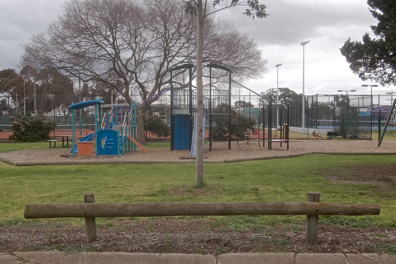
Melbourne was recently placed into its 5th lockdown since the pandemic began. I found this one more taxing the previous ones. By about the 7th day I decided I needed to get outdoors. I decided to walk aimlessly. Walking aimlessly is harder than it sounds.
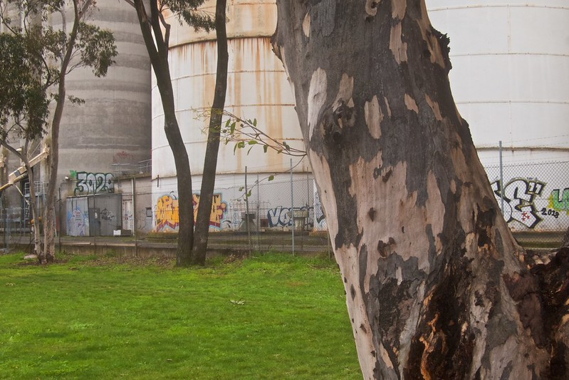
So I decided to walk into the park adjacent to our house. Then once on the other side of the park wander in the direction of some incongruous land. This land runs between a rail siding and the medium to light industry either side of it. This gives me access to places that are inaccessible any other way. Carrying a large camera (and tripod) in this instance may not have been permitted by the lockdown rules I suspect. So I carried my small Canon point and shoot as well as my iPhone 12.
I walked for about one and a half hours. I took approximately 6639 steps. Sadly I forgot to run my mapping software as I walked, so I’m using other software to trace my route. In this instance Aperture. I took very few iPhone pictures it seems, anyway. I manually added these images to Aperture’s map feature.

All up I took 189 pictures. Below is a small selection of them in chronological order.


The whole experience was definitely one of heightened senses, visual, aural and olfactory. This in my mind made the journey one that was entirely psychogeographic, even if only partially aimless.
Some changes are occurring in this area also. I have walked this area on and off since moving to Sunshine in 2000. When I next walk it, who knows? The ninth picture is about to undergo a major infrastructure project. This is one of the reasons I walked there. I shall return and use a film camera soon hopefully.
☛ Website | Flickr | Instagram | Photography links | Twitter | Tumblr ☚

Last weekend I walked from a small carpark west of the CBD to the Yarra river at Spencer Street. A distance of about 2.6 kilometres one way. All up 5.1 kms return.
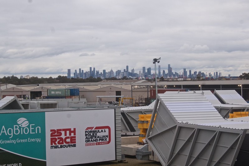
Upon my return I noticed an electricity tower was partially dismantled. I returned 5 days later and it has been completely removed. This view of the western edge of the CBD now clearly visible from the edge of the Moonee Ponds Creek, only because of the removed tower. I have other pictures in my archive on digital and film from this location.
‡ Website | Flickr | Instagram | Photography links | Twitter | Tumblr ‡

‡ Website | Flickr | Instagram | Photography links | Twitter | Tumblr ‡

This view did not exist in 2019. I can’t remember the last time I drove along Dohertys road.
I am standing on a bridge built for cyclists that forms part of the federation trail. I’m not quite certain when it was completed. Google maps most recent picture of this part of Dohertys road is from 2019. The new bridge forms part of the larger infrastructure works going on around the Westgate. The works are affecting the peripheral and arterial roads that run off it. This trail will allow cyclists to ride from Werribee to the city. It crosses Dohertys’ road a dual carriageway arterial road.
As I had not had a chance to really explore this part of Melbourne since we had spent so much time in lockdown last year. I decided to investigate several areas nearby that I know would have altered radically.
Dohertys road used to be a single lane arterial road. Given the real estate in this part of Laverton there would have been many many large trucks using this road. It is now a dual lane road which no doubt means the numbers will increase. Melbourne’s cyclists can now cross this road safely using this bridge.
The weather on the day I was there proved to be almost perfect for photography. Unusual for Melbourne in January. I suspect this will be a regular location now.
This approach to finding locations underpins my work. Not being able to wander and just follow my nose while we were in lockdown was stifling to say the least. At least it means there will be plenty more surprises waiting for me; all within a 10 minute drive from my house.
‡ Website | Flickr | Instagram | Photography links | Twitter | Tumblr ‡


