Flânuering during lockdown 5.0

Melbourne was recently placed into its 5th lockdown since the pandemic began. I found this one more taxing the previous ones. By about the 7th day I decided I needed to get outdoors. I decided to walk aimlessly. Walking aimlessly is harder than it sounds.

So I decided to walk into the park adjacent to our house. Then once on the other side of the park wander in the direction of some incongruous land. This land runs between a rail siding and the medium to light industry either side of it. This gives me access to places that are inaccessible any other way. Carrying a large camera (and tripod) in this instance may not have been permitted by the lockdown rules I suspect. So I carried my small Canon point and shoot as well as my iPhone 12.

I walked for about one and a half hours. I took approximately 6639 steps. Sadly I forgot to run my mapping software as I walked, so I’m using other software to trace my route. In this instance Aperture. I took very few iPhone pictures it seems, anyway. I manually added these images to Aperture’s map feature.

screengrab of map of walk taken 23-07-2021
The place I walked, 23rd July 2021

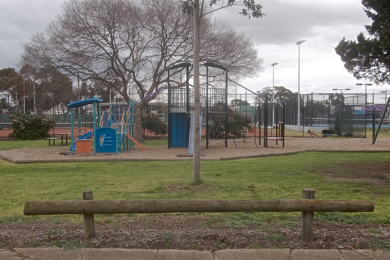
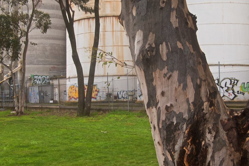
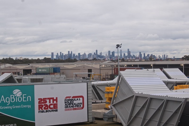
All up I took 189 pictures. Below is a small selection of them in chronological order.

Parsons Reserve facing South East 2021-07-23 14:51:59
Abstraction of urban forest Parsons reserve 2021-07-23 14:49:40
Trees and silos at the Western edge of Parsons reserve 2021-07-23 14:53:52
Wright Street Sunshine facing West with Silos in the background
Wright Street with Silos in the background, 2021-07-23 14:59:00
Linda Street Sunshine, facing South West 2021-07-23 15:04:47
Looking North from the Freight Rail siding in Linda Street Sunshine, 2021-07-23 15:08:13
Melbourne Container Park, from the rail siding. 2021-07-23 15:10:15
Looking North from the freight rail siding 2021-07-23 15:11:50
Track along the freight rail siding looking North with Melbourne Container Park in the background 2021-07-23 15:29:28
Facing South West overlooking the old 'Huntsman Refinery Site'. 2021-07-23 15:35:30
Facing South West overlooking the old ‘Huntsman Refinery Site’. 2021-07-23 15:35:30. Soon to be a major infrastructure site.
Melbourne Grand Prix infrastructure storage 2021-07-23 15:40:36
Pile of stone used as filler 2021-07-23 15:41:23
Texture, of a pile of stone used as filler 2021-07-23 15:41:23
Atop a rail siding overlooking Melbourne facing south east 2021-07-23 15:36:47
CBD Skyline with Melbourne Grand Prix infrastructure in storage 2021-07-23 15:48:00
Stony Creek and Environs looking West 2021-07-23 15:58:56
Wright Street, Sunshine. Facing North East. Sunbury Train line in the background. 2021-07-23 16:04:52

The whole experience was definitely one of heightened senses, visual, aural and olfactory. This in my mind made the journey one that was entirely  psychogeographic, even if only partially aimless.

Some changes are occurring in this area also.  I have walked this area on and off since moving to Sunshine in 2000. When I next walk it, who knows? The ninth picture is about to undergo a major infrastructure project. This is one of the reasons I walked there. I shall return and use a film camera soon hopefully.

☛ Website | Flickr | Instagram | Photography links | Twitter | Tumblr ☚

Photography, in Summer, in Melbourne Australia.

Western Edge of Melbourne's CBD, on an overcast Saturday morning.
Truck Parking Bay on the western fringes of the CBD, 2021-01-30 @ 10:38:20 on an overcast Saturday morning.
Photography  often takes a back seat in January for me. Summer photography has been prolific this year for me though.
The weather continues to be overcast in the mornings. This is somewhat unusual here in Melbourne, in January. I decided to get out and exploit this on Saturday. I went looking for spots to make pictures in and around the infrastructure projects going on. Close to home.
 
This truck holding bay is a favourite of mine due to its location and topography. You can see the CBD easily and in the right conditions make some good pictures of Melbourne.
 
The blue screens on the Citylink off ramp are the only clue that construction is underway. All the action is behind me here.  I wandered west with my ‘Blad and made a few pictures of some of the works going on. As I have yet to process this film it remains to be seen if I was successful.
 
At least I have some record of the changes that are occurring. This forms a major motivation behind what I am focusing on these days.

About the author.
Stuart Murdoch is an Artist and Part time Photo Educator, with over 30 years of teaching experience. He contemplates many things photographic. His ruminations include his own work as well other’s and the aspects of technology that impact on the sharing and consumption of Photographs. And of course the act of making and taking photographs in the 21st century.

☛ Website | Flickr | Instagram | Photography links | s2z digital garden | Tumblr

New Projects?

Bulla, Melbourne, Victoria, Australia. 2020-05-22 14:42:30

I have been thinking a lot of late about Melbourne International Airport lately. I regularly visit there as my wife travels frequently for her job. I often collect her and occasionally drop her off. I also love flying and aeroplanes generally. The history of the creation and development of Melbourne International Airport, or Tullamarine, is well documented. I can add my own history of the place too.  I was a young boy when construction wound down. I used to ride my bicycle there and wander around and explore. There was a working model of the airport showing how the ATC operated with moving models, and commentary. Which I have fond memories of.

While I do not currently live in the same postcode as the airport I am very close and can easily get there in a matter of minutes if the light beckons. Sometime in 2019 I decided to start visiting the edges of the airport to try and make interesting pictures, or perhaps document the changes as they occurred. I started the idea using colour. I have shot about six rolls of 120.

A day or two ago I went in search of more pictures near the airport. I took several cameras. But made no pictures on colour film of the edges of the airport. Using a DSLR I managed to scope some good spots that might be worthy of a revisit. One of the ideas that are floating in my mind as I think about this place is the use of the land on the edges of the airport, where does the airpot begin and end, how is it defined.

The edges of the airport are predominantly industrial as the nearest suburb is Gladstone Park on the southern edge. Sunbury is on its north western edge and Avondale Heights on its Southern edge. The industrial land close to the airport is mostly distribution centres with some training and maintenance facilities. These are ordinary concrete structures reminiscent of Lewis Baltz’s workThe New Industrial Parks near Irvine California’. I am hoping to avoid making picture of these. I’m more interested in how the land is used in an area that has largely been frozen in terms of development since the airport was constructed in the late 1960s.

The airport has its own postcode. Which makes preplanning visits easy. As I grew up in the area I have a knowledge of the environment that few would recognise. As a cab driver in my mid 20s. I learned all about accessing the airport from every direction too. I am using all this knowledge to visit and revisit areas in and around the publicly accessible areas of the airport. My current process is just wander/drive and see what turns up.

The image above, hosted on flickr is an example of that research.


About the author.
Stuart Murdoch is an Artist and Part time Photo Educator, with over 30 years of teaching experience. He contemplates many things photographic. His ruminations include his own work as well other’s and the aspects of technology that impact on the sharing and consumption of Photographs. And of course the act of making and taking photographs in the 21st century.

☛ Website | Flickr | Instagram | Photography links | s2z digital garden | Tumblr